There are a number of rock art sites in this part of Val Camonica
Between the eleventh and fourteenth centuries, Capo di Ponte was known as the hamlet of Cemmo—part of the priory of San Salvatore of Tezze.
In 1315 the Imesigo marsh, on the plain between Capo di Ponte and Sellero, was flooded by the River Re.
On 14 October 1336 the Bishop of Brescia, Jacopo de Atti, invested iure feuds[clarification needed] for a tenth of the rights in the territories of Incudine, Cortenedolo, Mù, Cemmo, Zero, Viviano and Capo di Ponte to Maffeo Giroldo Botelli of Nadro.
In 1698 Father Gregorio Brunelli says that the village of Zero (or Serio), which stood on banks of the River Re, east of the country today, was swept away by a flood.
After the fall of the Republic of Venice the "comune of Capo di Ponte" (1797–1798) was founded, later becoming "comune of Cemmo and Capo di Ponte" (1798 to 1815). Under the Lombardo-Veneto kingdom, the name was again changed to "comune di Capo di Ponte e Cemmo" (1816 to 1859). It has been known as Capo di Ponte since 1859.
Valcamonica is a north-south oriented valley, 80 km long, in the Lombards Alps, north of Brescia and Iseo Lake, almost two hours by car from Milan.
The name got its origin from a pre-indoeuropean people named Camunni, conquered by Rome in 16 BC.
The engraved zone (40 km long) corresponds to the lower part of middle valley, between the peaks of Concarena and Pizzo Badile Camuno (3000 meters high).
The latter Matterhorn-like peak always has a presence over the east side of the valley.
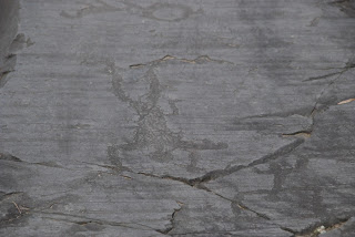
All the engraved figures are pecked in a hard permian sandstone, originally heavily polished by the Wurm glacier. This beautiful natural blackboard has now collected tens of thousands of figures from various prehistoric periods.
Pitoti, meaning puppets in the dialect of Valcamonica, is the term used by the indigenous population for the figures engraved by their ancestors.
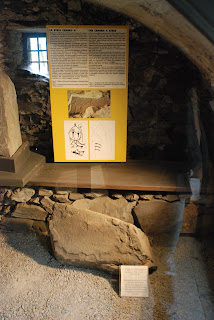
The engravings of the CAMUNNI were only noted in 1909 when Walter Laeng, a Brescian geographer, gave news about two engraved boulders at Pian delle Greppe of Cemmo in the municipality of Capo di Ponte: these two boulders are now one of the most important Copper Age monuments in Italy.

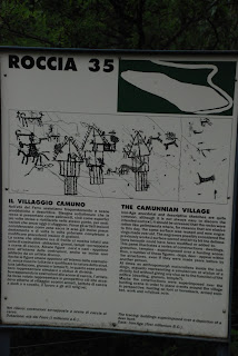
This is the sign that explains the park and what it has to offer. It's located near the entrance.
The park has coloured trails, i.e. an occasional sign here and there that, accompanied by a map, may let you find your way.
Personally, as regular readers will have already guessed, I got lost a few times and still have no idea where some of the tracks were but you don't get lost to the degree where you'll never be heard of again, more your misplaced for a minute or two.
Personally, as regular readers will have already guessed, I got lost a few times and still have no idea where some of the tracks were but you don't get lost to the degree where you'll never be heard of again, more your misplaced for a minute or two.
There is no extra charge to view it.


.jpg)
No comments:
Post a Comment